2002 Total Solar Eclipse
About the Eclipse
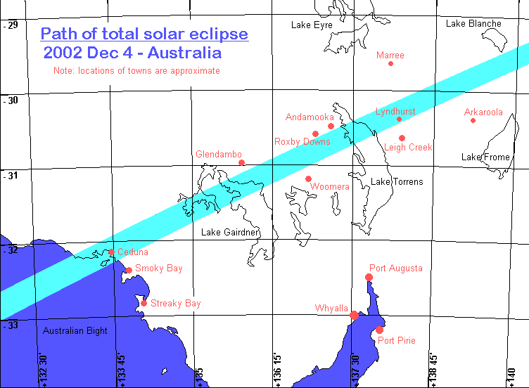
The eclipse path began on the 4th of December 2002 over the Atlantic Ocean, west of Africa. It crossed Angola, Mozambique and the Indian Ocean, before making its Australian landfall at Ceduna (South Australia) late in the afternoon (local time). The path of totality then headed northeast across the South Australian outback before leaving the Earth's surface east of Lake Blanche.
The only towns in the path of totality were Ceduna and Lyndhurst. Totality passed south of the towns of Andamooka, Glendambo and Roxby Downs, and north of Leigh Creek and Woomera.
Totality occured less than an hour before sunset for all these locations. This provided some interesting opportunities to photograph the eclipsed Sun with the local landscape.
The duration was 32 seconds at Ceduna (on the coast) and dropped to 26 seconds at Lyndhurst (northern Flinders Ranges). On the roads midway between Woomera and Glendambo, and midway between Woomera and Roxby Downs, totality was 30 and 28 seconds, respectively.
After crossing the coast, virtually all of the eclipse path was in remote and sparsely inhabited desert country.
Path of Totality
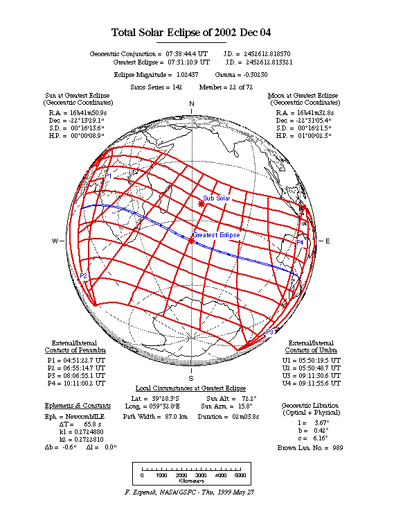
The Moon's shadow during a total solar eclipse has two parts: the umbra, where a total eclipse is seen, and the penumbra, where only a partial eclipse is seen. The umbra is quite small, perhaps as narrow as a few kilometres or as wide as a couple of hundred; whereas the penumbra is much wider, a couple of thousand kilometres or so.
This means, of course, that when a total eclipse occurs, it is only visible from a small part of the Earth, whereas the accompanying partial eclipse is seen over a much larger area. However, the shadow isn't simply a "spot" on the Earth; due to the movement of the Earth and Moon, and rotation of the Earth, the shadow actually races across the Earth's surface at around three thousand kilometres per hour, causing the Moon's shadow to "write" a long track across the Earth. This track is shown in the light blue part of the first map below.